
 KOR
KOR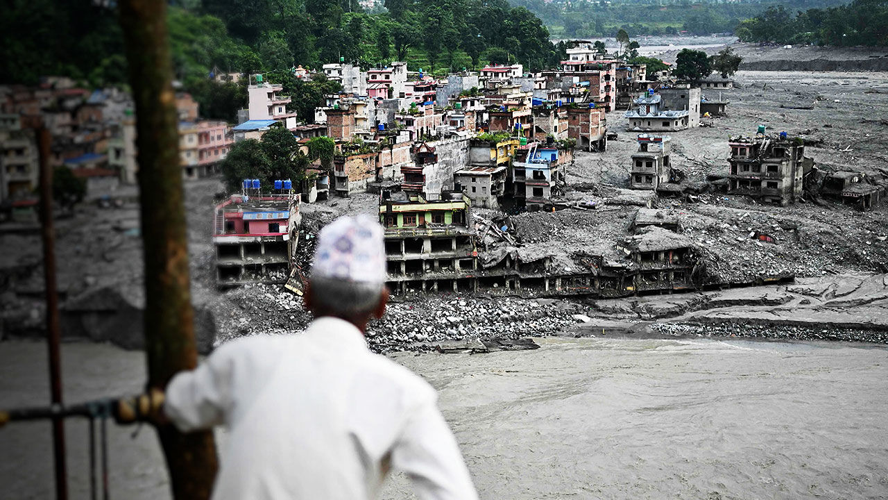
▲ The Nuwakot region in Nepal swept by severe floods
The total floor area of buildings exposed to flood risks in the Himalayan mountainous regions of Nepal, India, and China—where climate change is melting glaciers and increasing heavy downpours—is growing rapidly, with an estimated 290,000 people residing in these areas, a study showed.
An international research team led by Dr. C. Scott Watson of the University of Leeds announced these findings on October 9 in the scientific journal Scientific Reports, stating that an analysis of the Himalayan regions in Nepal, India, and China revealed that the building area within a vertical height of 50 meters from river channels surged by approximately 46% between 2016 and 2023.
The research team noted that the study demonstrates an increase in buildings and populations vulnerable to floods across Himalayan river basins, adding that improving the accuracy of building and population data and complementing analyses that reflect actual flood characteristics are essential to more accurately assess disaster risks and prepare countermeasures.
Flood risks in high-altitude basins like the Himalayas are driven by changing seasonal monsoons, extreme precipitation events, and low-frequency yet high-impact phenomena such as debris flows and glacial lake outburst floods (GLOFs).
Glacial lakes, which form as glaciers recede, are particularly potential sources of outburst flood hazards.
In steep mountainous terrain, floods and debris flows can cause catastrophic damage to downstream communities and infrastructure.
The floods in the Nepalese Himalayas that occurred in late August, while not glacial lake outburst floods, illustrate how devastating high-altitude floods can be for local communities and infrastructure.
The research team selected 1,361 glacial lakes spanning Nepal, India, and China (Tibet) and analyzed the river channels and basins extending up to 50 kilometers downstream from each lake.
To identify the distribution and changes of buildings exposed to flood risks, they compared five open datasets, including Google building data.
Among them, Google Open Buildings Temporal 2.5D (OBT), which tracks annual building changes and is evaluated for high building detection accuracy, was utilized for the analysis.
Based on the premise that the topographic location around rivers in steep mountainous terrain can serve as an indicator of flood exposure, the team analyzed the area of buildings located within a vertical height of 50 meters from river channels.
The results showed that the building area within a vertical height of 50 meters from river channels expanded by 45.75%, rising from 12.38 square kilometers in 2016 to 18.04 square kilometers in 2023.
The building area falling within the potential inundation zones of glacial lake outburst floods also grew by about 77%, from 0.72 square kilometers to 1.28 square kilometers over the same period.
Analyzing population data for these regions, the researchers estimated that 293,800 people live in areas within a vertical height of 50 meters from river channels in the studied river basins.
This accounts for approximately 18% of the total population in those basins.
Notably, in Nepal, an estimated 108,500 people reside within a vertical height of 50 meters from river channels along glacial lake outburst flood paths, while around 22,800 people live within a vertical height of 10 meters.
Furthermore, between 2015 and 2030, the population living within a vertical height of 50 meters from river channels in the studied basins—including the border regions of Nepal, India, and China—is projected to increase by 17,900 people (about 6%).
The research team pointed out that an increase in buildings near rivers and within potential inundation zones of glacial lake outburst floods in high-altitude areas like the Himalayas could result in a correspondingly greater number of facilities affected when floods occur.
However, they noted that the building data used in the study contains omissions and misclassifications, and that the resolution and accuracy of topographic data can also affect estimation results. They emphasized that securing annually verified building and population data can help improve flood risk identification, early warning systems, land-use planning, and disaster prevention investments.
※ Please note: This article was translated by AI and may contain errors.


 Video News
 Video News
 Video News

 Video News