
 KOR
KOR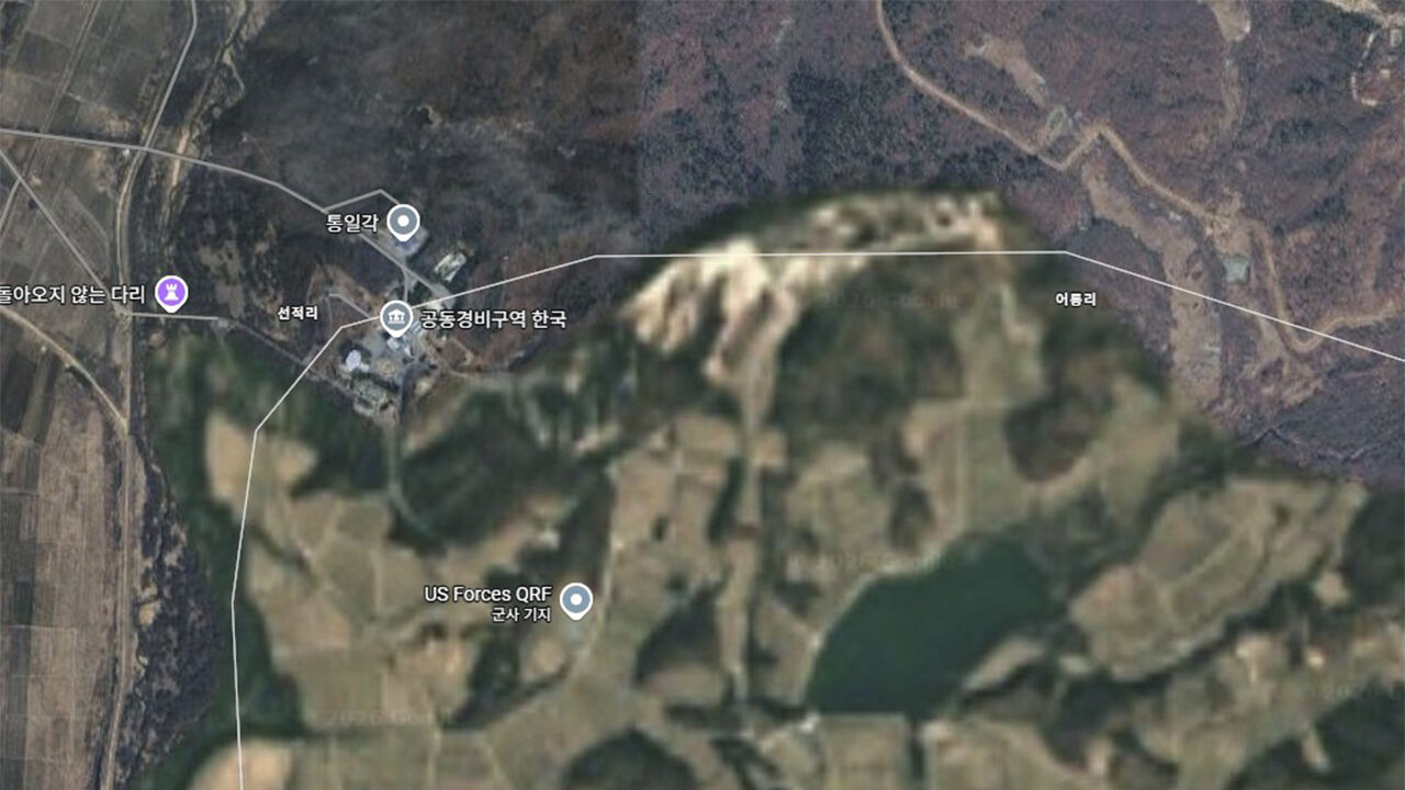
▲ Areas south of the Military Demarcation Line in Paju, Gyeonggi Province, shown blurred.
Google Maps has begun blurring satellite imagery of military facilities and the Demilitarized Zone (DMZ) in South Korea, US-based North Korea-focused media outlet NK News reported on the 9th (local time).
According to the report, high-resolution images of dozens of military facilities and more than 400 square kilometers of South Korean territory previously viewable on Google Maps and Google Earth have been replaced with mosaic-level, low-resolution images.
Images of key security facilities, including the DMZ area south of the Military Demarcation Line, major South Korean and US military bases, and the area around the presidential office, have essentially been obscured in this manner.
It was also confirmed that Google Maps has suspended coordinate display functions for the entire South Korean territory and North Korean regions within approximately 35 kilometers north of the DMZ.
However, coordinate checking remains available on Google Earth.
This measure follows Google's acceptance of conditions set by the South Korean government in order to export high-resolution map data of South Korea to overseas servers.
Domestic law stipulates that domestic mapping services must obscure satellite imagery of military and security facilities.
Google had previously refused to apply domestic laws on the grounds that it was outside South Korea's jurisdiction by using overseas servers, but it ultimately changed its policy to secure the data necessary to improve its mapping services in South Korea.
In September of last year, Google announced a policy to comply with security regulations in order to significantly improve domestic mapping services, including navigation functions, and compete with South Korean companies such Naver and Kakao.
Consequently, the South Korean government decided on conditional approval in February of this year, and Google reportedly began map modification work starting last month.
This measure is expected to make it significantly more difficult for North Korea to acquire high-resolution images of sensitive facilities in South Korea.
However, concerns have also been raised that Google's changes could backfire by tipping off North Korea as to which regions South Korea considers most sensitive and has chosen to conceal.
North Korea may still be able to check detailed appearances of those locations through data from other satellite imagery providers that do not obscure the areas, or through its own future satellites.
(Photo: Google Maps screen capture, Yonhap News)
※ Please note: This article was translated by AI and may contain errors.



 Video News
 Video News

 Video News
 Video News